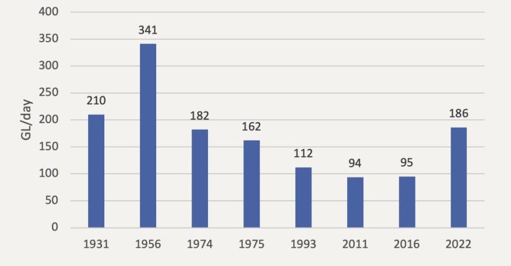
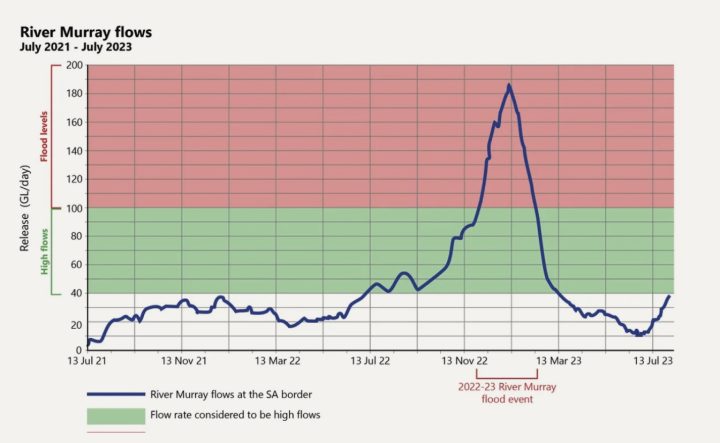
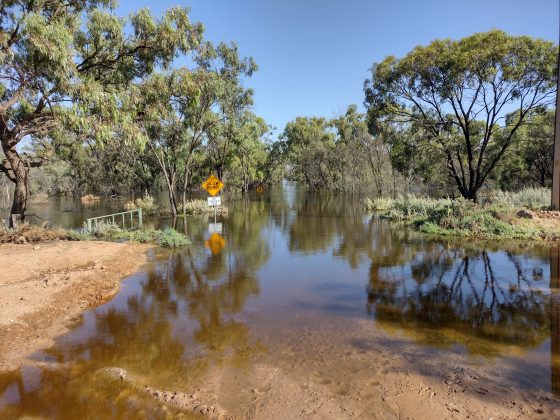
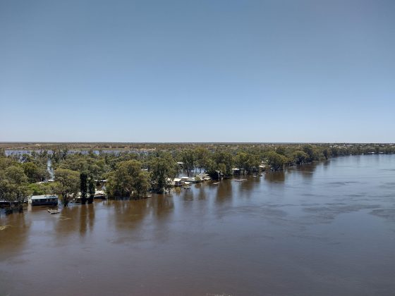
2022–23 River Murray Flood

Environmental outcomes of the River Murray flood have so far included:
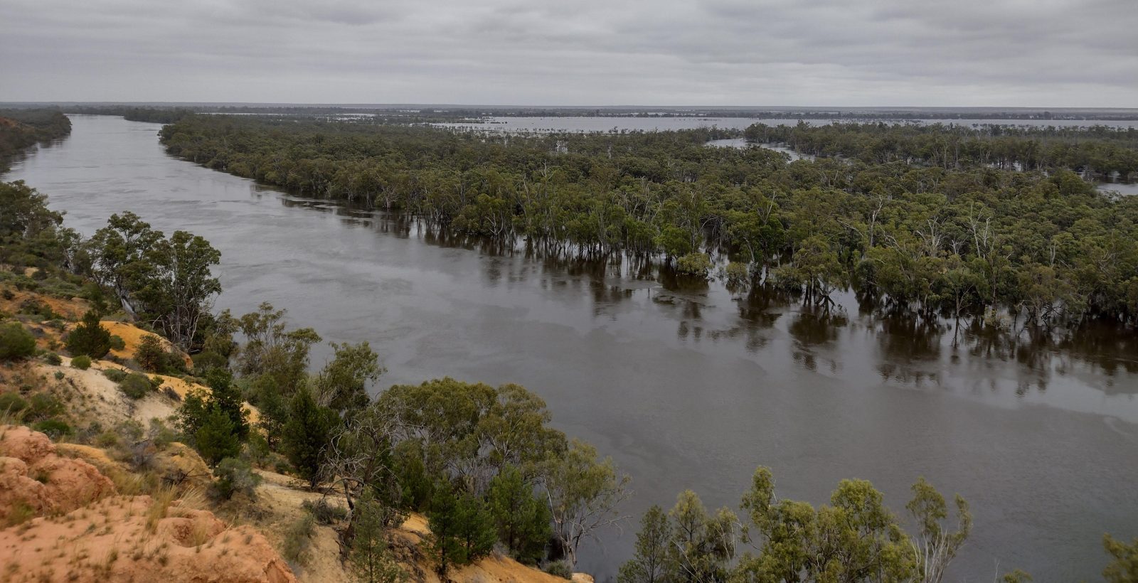
- Full reconnection of river, floodplain and estuarine environments, supporting the flow of water and improvements to water quality due to the flushing out of salt and nutrients from the river system.
- Vegetation growth and improvement in tree health and quality of understorey vegetation. This, along with more water in our wetlands, will support the cycle of life to sustain populations of insects, frogs, fish and birds.
- Provision of much-needed water to areas of the floodplain and wetlands that had not seen water for more than 60 years. This is supporting a boom in frogs, fish, turtles and birdlife across the river system.
- Connecting the river with floodplains and wetlands enabling fish dispersal and movement into new habitats along the river. Increased water flows also benefit the recruitment of native fish, other animals and plants.
- A drop in salinity levels in groundwater around the floodplains that will hopefully have lasting benefits for native floodplain vegetation, including River Red Gums.
- Opening of the Murray Mouth and the ceasing of dredging for the first time since 2015 enabling better exchange of water between the ocean and the Lower Lakes and Coorong.
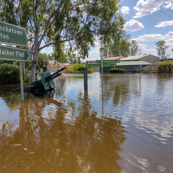
However, it is acknowledged that the River Murray floods did significantly impact native wildlife and people’s livelihoods, including:
- Damage to infrastructure and housing, and agricultural land. It is estimated that approximately 3,500 private residences and 4,000 hectares of agricultural land were damaged over the course of the flood.
- Livestock and wildlife mortalities.
- Generating considerable volumes of debris and waste during both the flood event and the clean-up afterwards.
- Impacting tourism, due to restrictions placed on activities such as fishing and boating (including houseboats) to protect human safety and damage to riverfront shack accommodation, especially over the summer holiday period.
- Increasing the length of transport routes due to ferries being unable to operate and road closures.
Flooding also resulted in fish kills, predominantly consisting of carp, which occurred along the beaches at Goowla and Middleton as a result of them being flushed out to the marine environment from the high flows of the floodwaters.
The Department for Environment and Water (DEW) has worked with the Goyder Institute for Water Research to undertake monitoring and research to improve understanding of how the River Murray environment responds to high flows and help inform management of riverine, floodplain and wetland habitats in the future. Further research is also being delivered by the Goyder Institute and research partners to investigate the influence of high flows on the health and function of the Coorong ecosystem.