For the first time, the SOER has included the views of Aboriginal peoples on How Healthy is Country and aims to better represent the role and opportunity for Aboriginal peoples in looking after Country. The EPA has commenced the journey of walking together with Aboriginal peoples in the development of the SOER. The EPA acknowledge however that we need to further develop and enhance our relationship with Aboriginal peoples to better integrate cultural knowledge with western science in reporting on the health of Country
The artwork by Ngarrindjeri artist Jordan Lovegrove (Karko Creations) represents the EPA and their dedication to safeguarding the environment and reporting on the state of the environment. It also highlights the vital role of Aboriginal peoples in land and sea management and the importance of monitoring the 'Health of Country.' The central meeting place symbolises the EPA, while background patterns reflect South Australia's landscapes, with green and ochre representing the land and blue symbolising the sea and rivers.
The artwork underscores the deep connection between Aboriginal peoples and their homeland, their shared mission to protect the environment for future generations and the celebration of diverse Aboriginal communities working together for the wellbeing of South Australia.
Aboriginal Nations
Aboriginal and Torres Strait Islander Australia is made of distinct groups, each with their own culture, customs, language and laws. Aboriginal people can only speak for their own Country. South Australia is home to over 30 Aboriginal language groups.
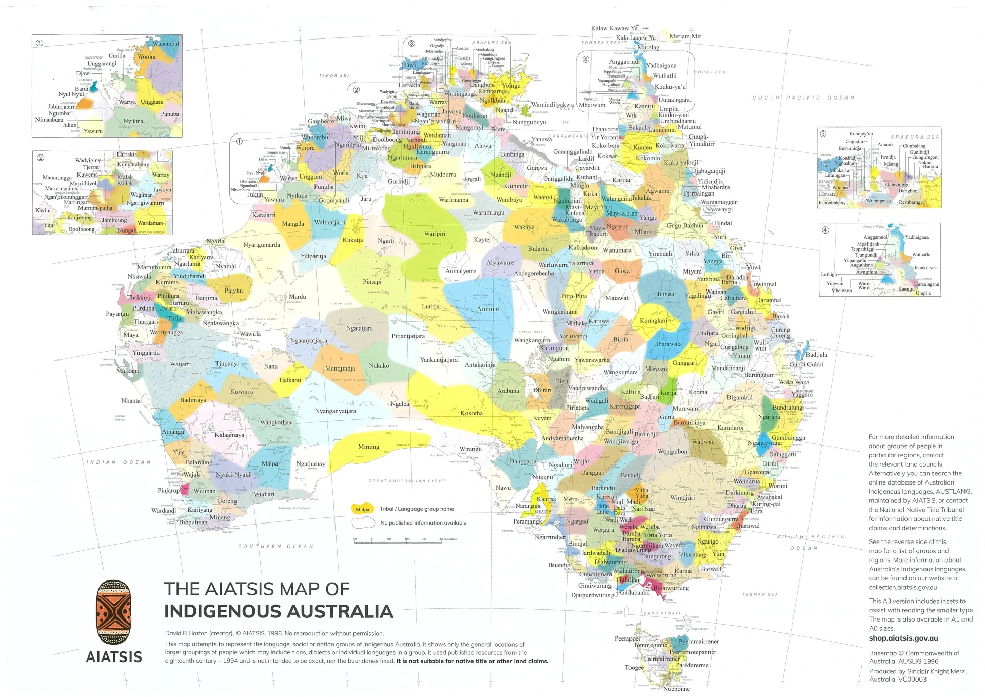
The Australian Institute of Aboriginal and Torres Strait Islander Studies (AIATSIS) provides an interactive map showing Indigenous nations across Australia.
Importantly, the map comes with a qualifying statement:
This map attempts to represent the language, social or nation groups of Aboriginal Australia. It shows only the general locations of larger groupings of people which may include clans, dialects or individual languages in a group. It used published resources from the eighteenth century-1994 and is not intended to be exact, nor the boundaries fixed. It is not suitable for native title or other land claims.
David R Horton (creator) ©AIATSIS 1996