Published:
Author:
The majority of Kangaroo Island (KI) farmers are reliant on winter and spring rainfall generating surface water runoff and watercourse flows to meet their stock water needs. They generally capture and store their water in numerous small dams. Watercourses on KI are predominately ephemeral and the scarce runoff and streamflow in watercourses over summer and autumn is usually too saline for use. Groundwater, where present, is often saline and the aquifers only allow for very low rates of extraction. Public water reticulation is limited and only services three towns and a narrow strip of landholders along the pipeline. During the recent drought from 2017–20, many landholders resorted to expensive and/or time-consuming water carting to see them through.
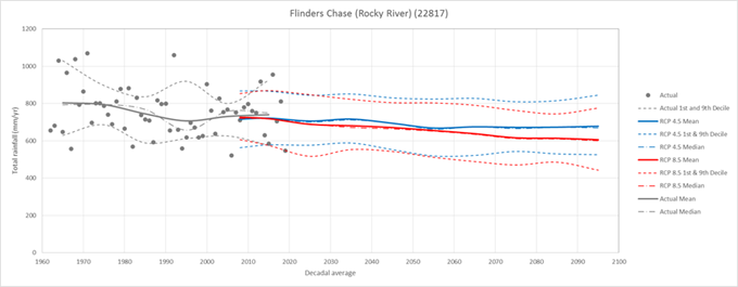
Climate change model projections for Kangaroo Island under RCP4.5 and RCP8.5 scenarios (relative to a 2011–20 baseline) indicate that by 2090 potential evaporation will have increased between 3–8% across the island. Rainfall is predicted to decline between 6–18% by 2090 with decreased surface water runoff and an increase in droughts and intense rainfall events also expected.
Droughts take a heavy toll on communities and innovative approaches to water management on KI are needed to reduce the impact of future droughts. It is hoped that by providing better information and support, the KI Landscape Board can improve the drought resilience of the community, reduce the proliferation of small, low-security dams, prevent further stress to water sharing between landholders and increase the viability of businesses that rely on healthy, water dependent ecosystems.
The KI Landscape Board has developed detailed information on how climate change is likely to impact rainfall, surface water flows and farm dam water security on KI. This has given land managers vital information to inform their water security planning and preparation for future droughts.
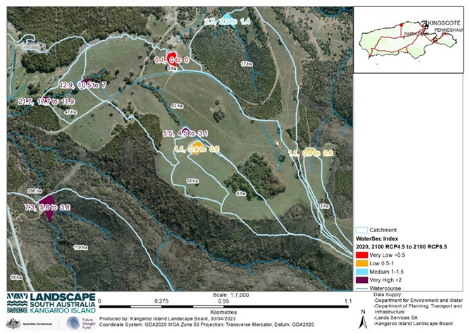
A high-resolution digital terrain model was developed and used satellite imagery and downscaled global climate model projections of rainfall and evaporation under 2 greenhouse gas emissions scenarios (RCP4.5 and RCP8.5), at 10 weather stations across the Island, to develop water security indices and calculate future inflow volumes predicted to occur as a result of climate change, at a regional and property scale. This data was then used to develop property-scale water security plans that identify current and forecasted changes to water security for all existing farm dams on Kangaroo Island. The plan maps show a combination of property hydrology, current water security and water security under RCP4.5 and RCP8.5 scenarios in 2050–60 and 2090–2100, for farm dams.
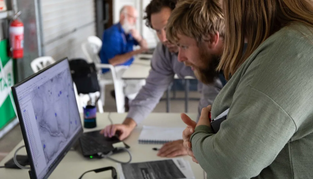
Extension activities provided advice on interpreting the maps and gave information about methods to reduce evaporation and enhance runoff, along with information on the benefits of water reticulation systems and consolidating low water security dams into fewer, better sited, higher water security dams. Two demonstration sites were also established to promote practical ways to enhance runoff and water security: one demonstrating a graded catchment in conjunction with keyline contours connecting two dams and increasing the catchment area, and the other demonstrating a plastic-lined catchment.
The positive outcomes of this work are expected to continue into the future. The demonstration sites and water security maps will continue to be used to increase understanding and knowledge of climate change impacts and strategies that can be employed to increase on-farm water security on KI. The creation of over 300 water security maps for over 50 landholders led to a high level of interest and strengthened relationships between the Board and landholders.
The KI Landscape Board will continue to promote the outcomes of the project and will work with demonstration site landowners, and the farming community in general, to increase on-farm water security, and strengthen the adoption of drought resilience land management practices, systems and approaches.
To date approximately 120 farmers and landholders (individuals and businesses) have engaged with this work through workshops, demonstration sites, water resource assessments and surveys and receiving mapping products and advice.
This work was supported by the Kangaroo Island Landscape Board, through funding from the Australian Government’s Future Drought Fund.


